Of course we went the scenic route. The Three Capes Scenic Loop, to be exact.
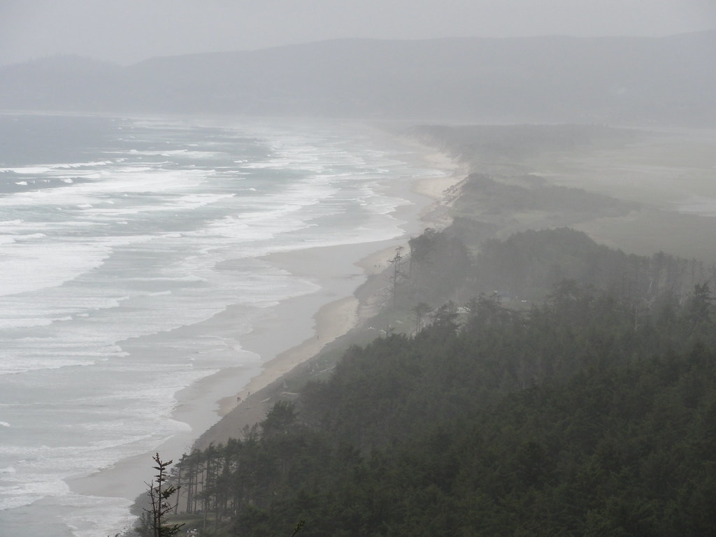
You can see an astonishing variety of geology in a very short amount of time along this loop, including one of the rarest of sights on the Oregon coast: a sandstone cape. But if you're driving north up the loop, the first thing you'll notice upon reaching Cape Kiwanda State Park is sand. Lots and lots of sand.
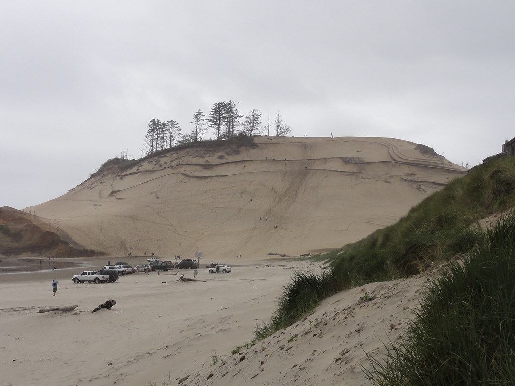 |
| Dunes at Cape Kiwanda |
Here, you're catching a glimpse of what the beaches were like fifteen million years ago, before the basalt came. And yet, basalt is the reason it's still here.
 |
| Haystack Rock (not to be confused with the other Haystack Rock) |
Right. Let's see what it's protecting.
 |
| Cape Kiwanda |
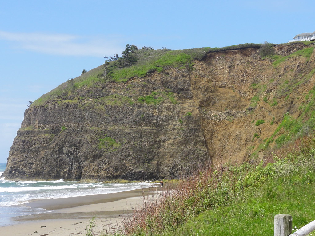
Until now, all we've caught are glimmers and glimpses of the Astoria Formation. Here, it's bold and beautiful, standing naked and proud without so much as a stitch of basalt on. And with that jaunty cap of vegetation, it looks positively saucy. It seems to know it's special.
We didn't have time to trudge through the sand to get to it, but even from a distance, through a misty morning, the butter yellows and russet and umber colors stood out.
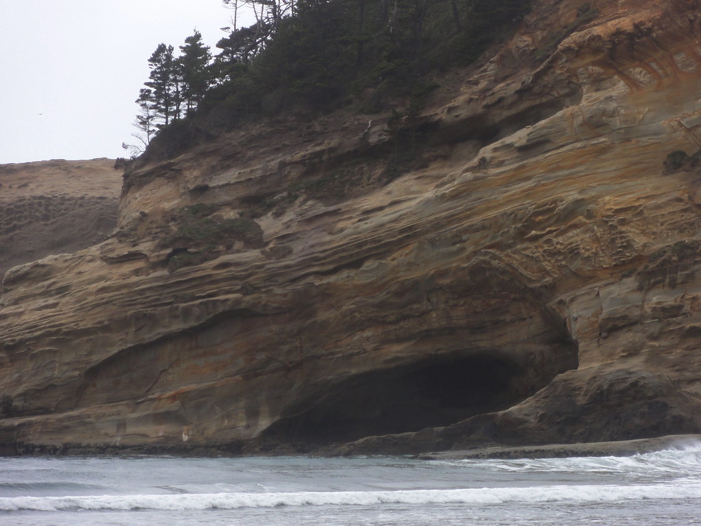 |
| Cave and Color |
Oh, how I wanted to go play in that cave! Run my hands over the sands, trace its history, drink it all in. It's got stories to tell of a time when the Oregon shore had finally made it almost all the way west. In the Miocene, sand piled up offshore in bays, submarine fans spread out from the young coast, and sea life lived it up for a while. Then came the Columbia River Basalts, which proceeded to throw a clam bake on a scale never before seen in these parts. Happily for the sea critters, the basalt stopped coming for about ten million years. Unhappily for it, sea levels dropped in the late Pliocene, and spent the Pleistocene bouncing up and down like restless kids on a trampoline while glaciers advanced and retreated.
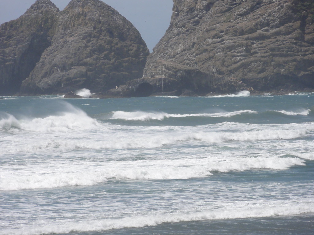
This part of the coast has been rising since the Miocene, and now bits of the Astoria Formation stand out above the waves. Most of the nekkid bits of it got eroded away for their troubles, but thanks to the Grande Ronde, this bit of it can stand up to the waves and laugh. Not that waves don't still attack it. You can stand on the beach and watch wave after wave hit, gradually sculpting the cape into fantastic shapes.
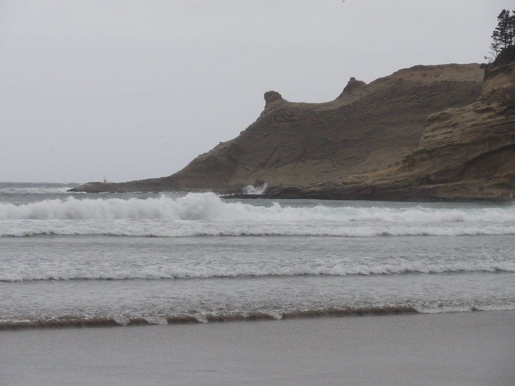 |
| Waves Hit the Cape |
On your way out, don't forget to stop by and pat the massive sandstone wall.
 |
| Sandstone Wall Goodness |
Back to the Three Capes Scenic Loop we went, and swooped inland a bit, then climbed and climbed and came through a haunting little forest that gave out on one of those views that make you look wildly for a pullout. And as we stepped from the car, we saw a plaque.
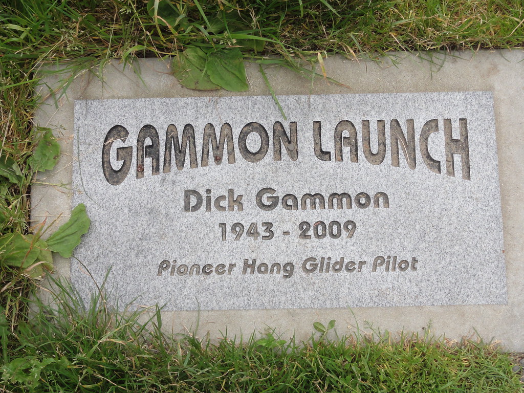 |
| Gammon Launch |
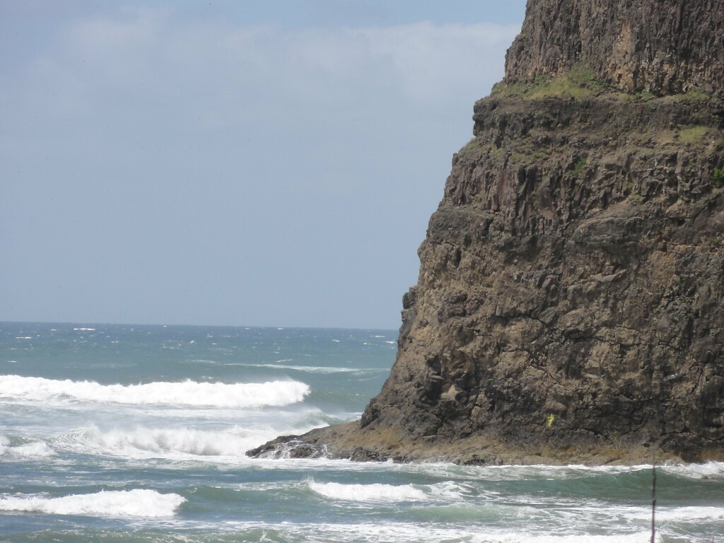
Oh, yes, we're back to basalt. But what makes Cape Lookout special is its shape, and what that shape tells us about it. If you look at a map of the coast, you'll notice most of those massive basalt headlands are blunt and round. This one sticks out like the paw of a very eager pointer.
It juts two miles into the sea, with cliffs up to eight hundred feet high. Alas, we didn't get a good view of it, but a hell of a view from it.
 |
| From Anderson Viewpoint |
Even on a misty day, even just on a ten-minute stopover, you can see an amazing amount of geology. So let's feast our eyes, then, shall we? We'll begin with a nibble at a wave-cut bench:
 |
| Wave-cut Bench |
Now, let's take a broader view.
 |
| Netarts Spit |
Now, the really neat thing about Netarts Spit is that it's merely an erosional remnant of a maclargehuge elongate dune that marched northeast. It used to be connected to the mainland at its north end. Then the seas rose at the end of the Pleistocene Ice Age, and the dune, stabilized by vegetation, found itself getting sliced open by the newly vigorous sea.
Those risen seas were also responsible for what you see looming out of the mists in the distance.
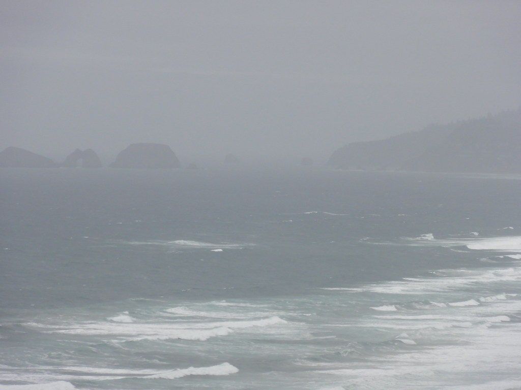 |
| Three Arches |
Speaking of no time, we had none. Time to meet up with Suzanne in Oceanside. You'll think it's a new day, but this is how rapidly the weather changes in Oregon. It took us just half an hour to drive up by Netarts, collect Suzanne, and enthrone ourselves in a very nice coffee shop with a view of the ocean. By then, the sunshine shone and the whole world sparkled. And Maxwell Point basked.
 |
| Maxwell Point and Three Arches Rocks |
I couldn't find much on that fault, alas, but one thing's for sure: when the ocean gets done carving away the basalt buttress, the rest of Maxwell Point's not going to be long for this world. Looks distinctly sedimentary, that stuff on the right. One day, I'll get back there and have a good long look at it, and scare up some geologic info. There's supposed to be a tunnel through it, even.
For now, let us turn our attention to the Three Arches.
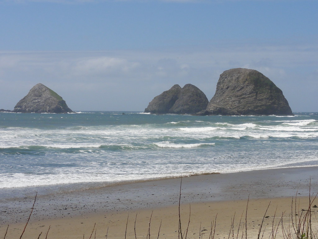 |
| Three Arches |
Granted, from this angle, they don't look much like arches. In fact, you won't see how archy they are until we make it up to Cape Meares State Park. But they have got arches, which likely began their lives as little sea caves or tunnels, back when this was all part of the headland. Time and tide have dissected them neatly, and now they're a refuge for all sorts of local wild life: sea lions and murres, mostly.
This is a good place to stand and watch the waves work.
 |
| Working Waves |
You can see the sea nibbling at Maxwell Point's toes, where they've got a good start on a wave-cut bench.
 |
| Wave-cut bench at Maxwell Point |
And yes, all of that nice thick basalt you see is our old friend the Grande Ronde. It's what you might call ubiquitous around here. In fact, we're about to see great gobs of it. On the other side of Maxwell Point lies Cape Meares State Park, where we shall look a lighthouse in the eye and see an upside-down waterfall.
Ye olde indispensable volumes of reference as the author was trying to make sense of it all:
Fires, Faults and Floods - one of the best roadside guides to the Columbia River Basin evah.
In Search of Ancient Oregon - simply the most beautiful book written about Oregon's natural history.
Hiking Oregon's Geology - chock full o' adventurous goodness sure to help you get your rocks on.
Northwest Exposures - tying the whole shebang together in one easy-to-follow narrative.
Cataclysms on the Columbia - the book that truly helped me comprehend the incomprehensible.
The Restless Northwest - short, sweet, and yet comprehensive guide to Northwest geological shenanigans.
Roadside Geology of Oregon and Roadside Geology of Washington - indispensable references and inspirations.
Glacial Lake Missoula and its Humongous Floods - not only an informative guide to the discovery and history of the Floods, but an apt title, too!
And guest starring the following links:


3 comments:
yay -- netarts! lard love a duck, i've been to oceanside a buncha times and never noticed that fault.
Now that you have seen the downstream ends (that are exposed) of the Grande Ronde basalt, you need to get to central and eastern Or, to see the sources of the basalt. Indications of fissures 5 to 10 m wide that erupted the basalt, give a hint of how much lava was flowing. Anyway in that part of Oregon there is a lot less vegetation to hide the rocks.
In one sense it would have been interesting to see the flows in action, but in another it might have been a good way to get cooked as well.
Misty or not this leg of the trip looks like great fun. It' been far too long since I ran in the sand dunes.
Post a Comment