Well, that and some waterfalls.
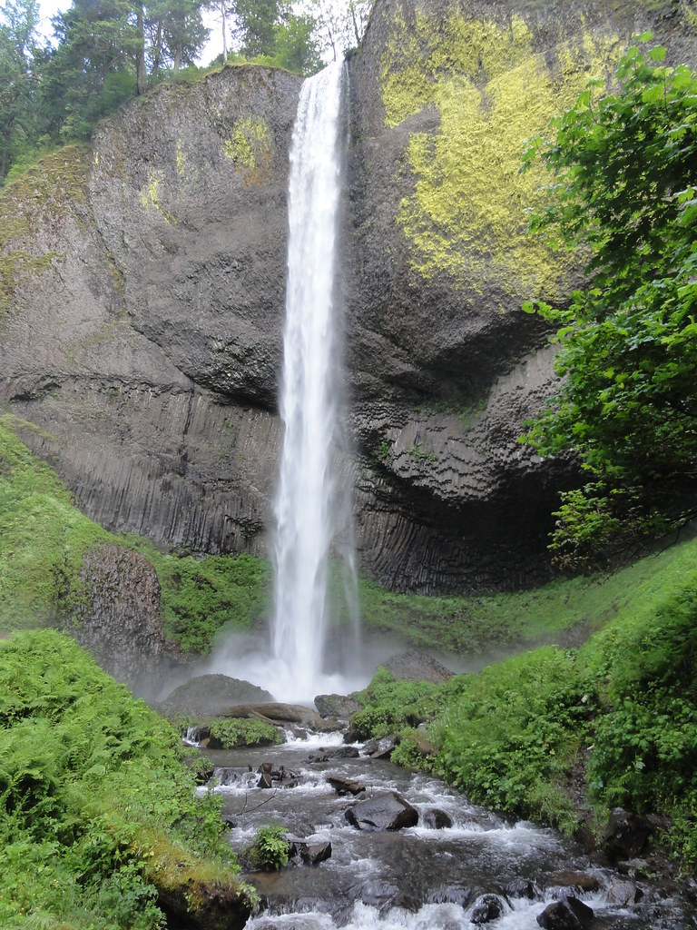
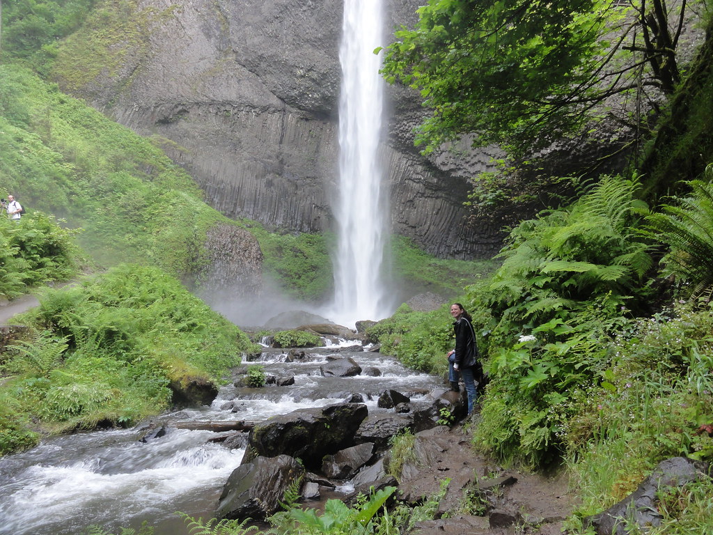
Nothing too spectacular, mind. I mean, we're only going to see the second highest waterfall in the United States. It just plunges 620 feet over sheer cliffs of Columbia River Basalts. It's just sort of, y'know, kinda like ZOMG WTF holy haleakala Batman!
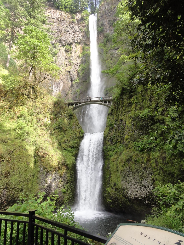 |
| Multnomah Falls |
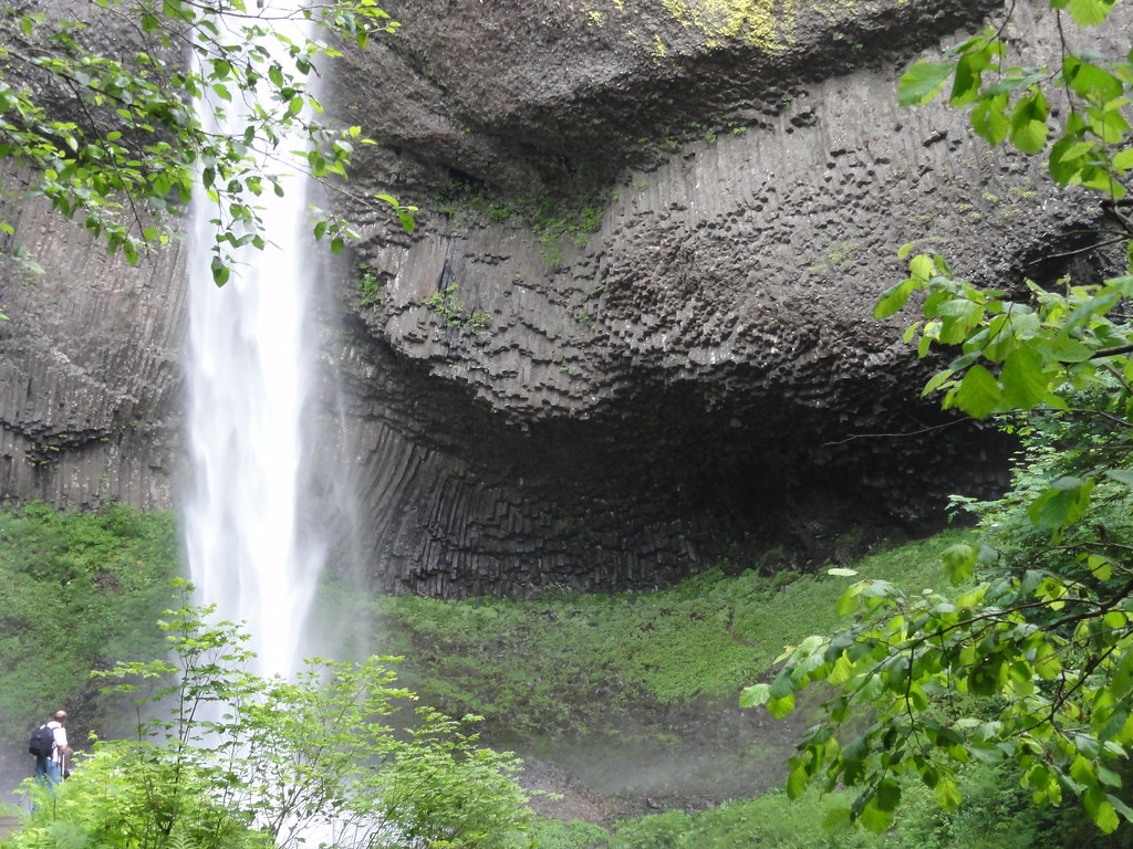
Stared enough? Okay. Let's talk geology, then.
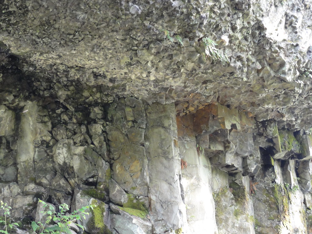
Over the course of 400,000 years, flow after flow of Columbia River Basalts laminated the landscape in thick black basalt. You can see quite a few of them in the cliff Multnomah Falls cascades down. Up by the lip there, you can see a wee colonnade, followed by a black band of pillow lava. I want to pause at pillow lava for a moment, because that tells us something fascinating about the history of this place. A casual glance at this enormous, solid cliff gives the impression that it was all basalt all the time back then, but the pillows say, "No, wait - it wasn't always flow after flow of blazing hot lava round here. Look, there was even a pond, or maybe a little lake, right here. Well, until the next wave of molten rock came through, anyway."
That picturesque pond of water formed on top of a rather thicker previous flow, which you can see as an entabulature and colonnade. Those three flows pretty much take up the whole of this photo.
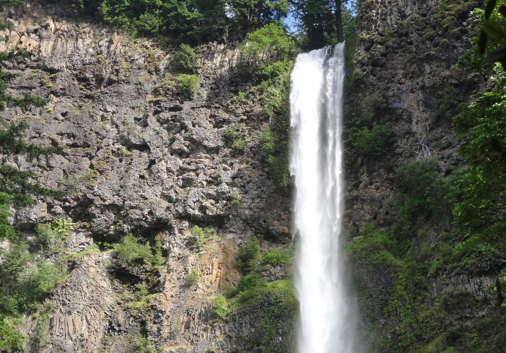 |
| Top o' Multnomah |
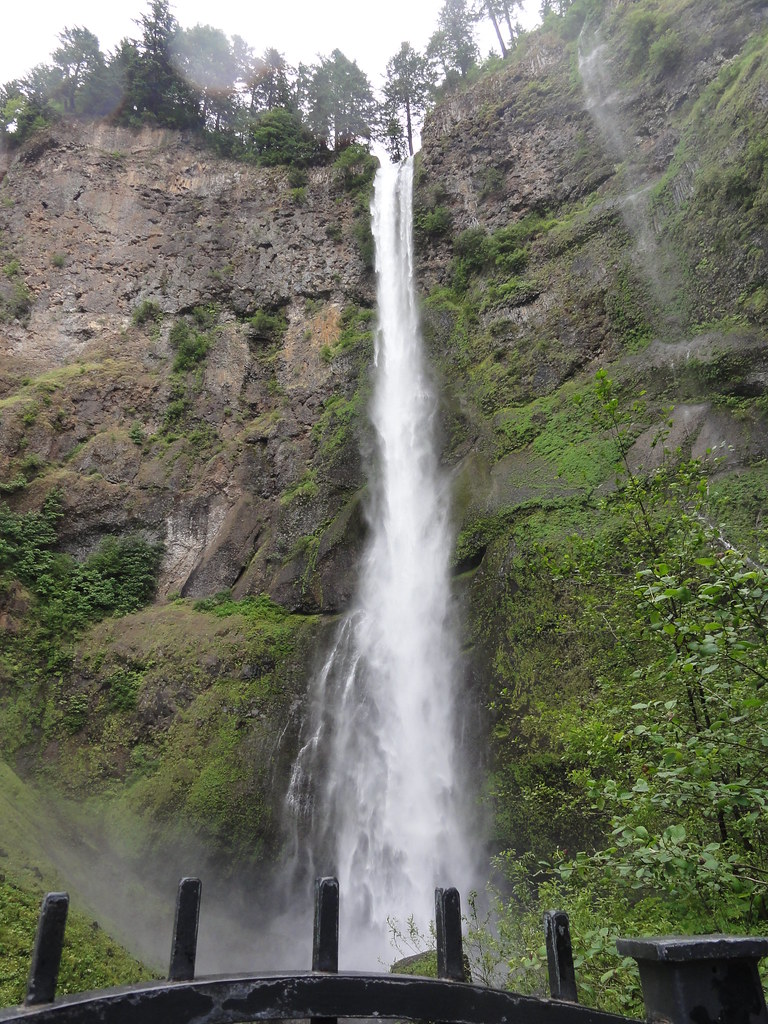 |
| Multnomah Falls - Upper Falls |
Let's have a look into the plunge pool, shall we?
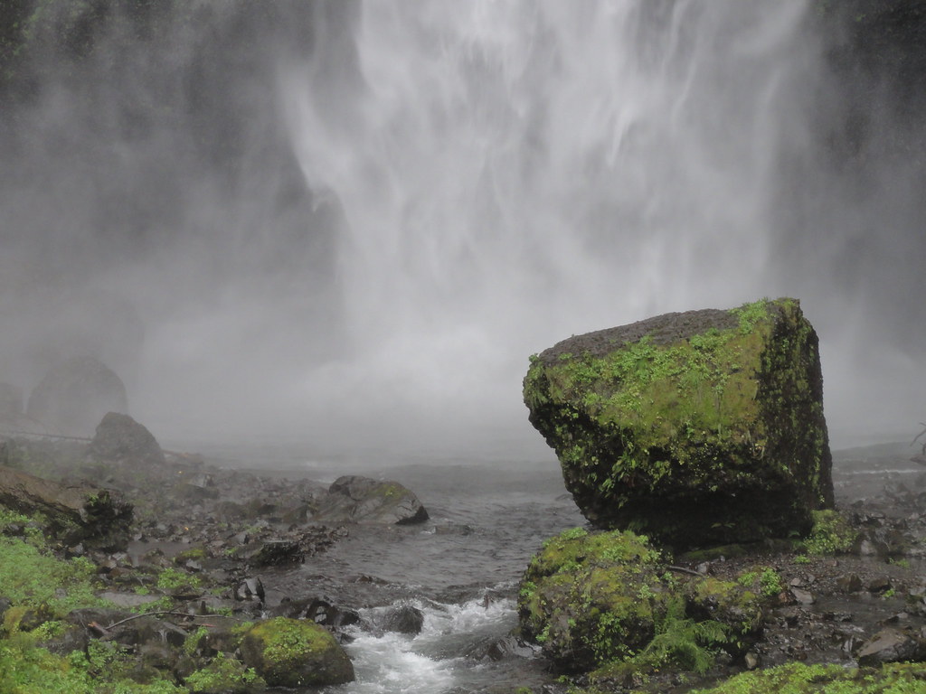 |
| Multnomah Falls Plunge Pool |
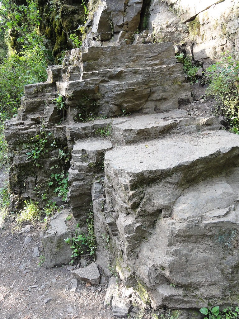
While you're wandering the trail at Multnomah, don't forget to have fun away from the falls. There's some delicious geology, including a nice, cozy cave.
 |
| The Cave and I |
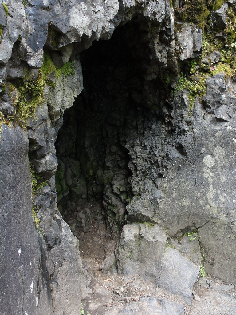 |
| Cave |
And a nice, close view of basalt here:
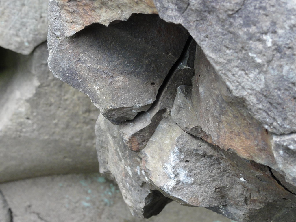 |
| Basalt |
Multnomah Falls has carved itself a respectable ampitheatre over the years. The view from beside it is utterly spectacular:
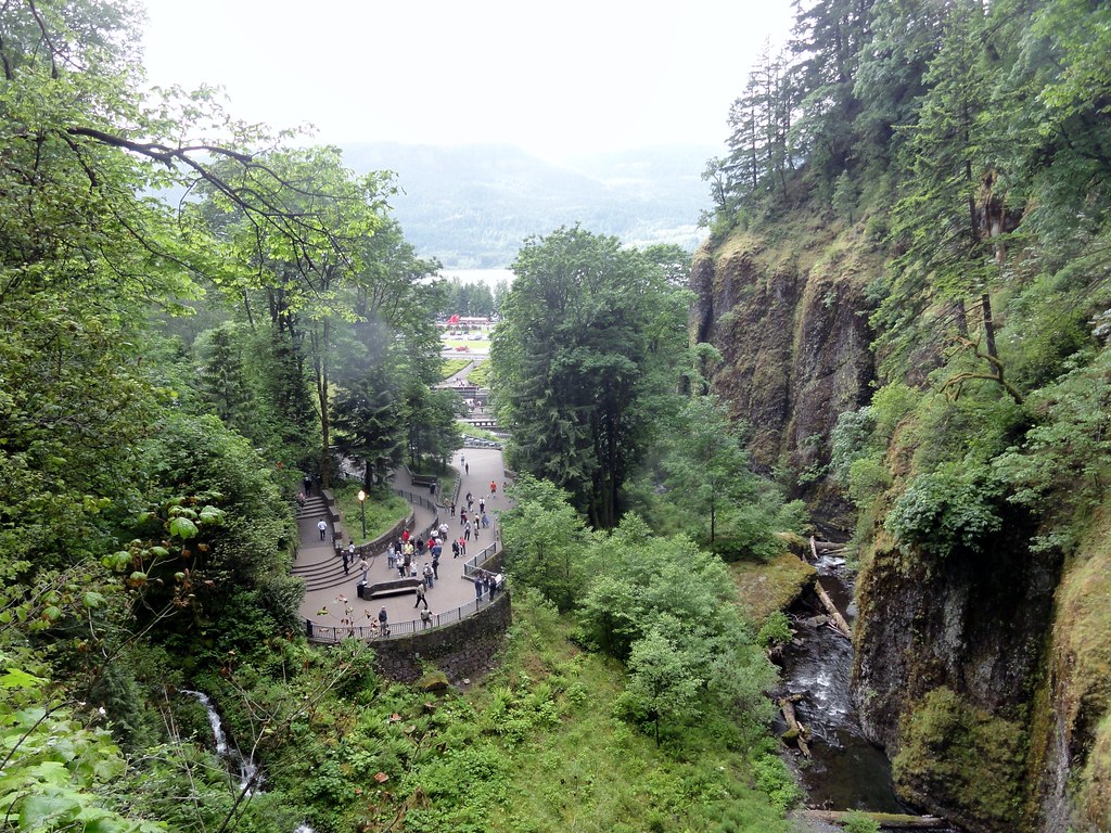 |
| Ampitheatre |
So, you've seen the second tallest waterfall in the United States and gotten really intimate with the Columbia River Basalts. You may think nothing else can live up to that and your adventures are over, but what you need to do is drive down Samuel C. Lancaster's delightful historic highway. The scenery is spectacular and the geology even more so. Check this out:
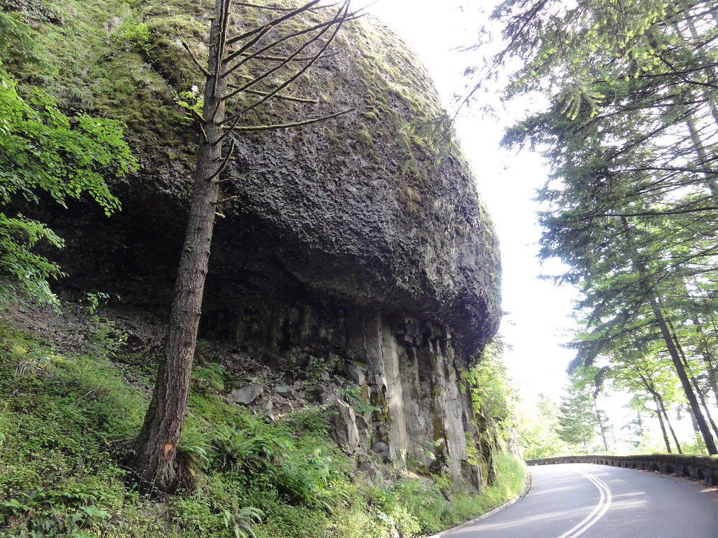 |
| Basalt Mushroom! |
 |
| Boundary Between Colonnade and Entabulature |
 |
| Ooo, Platy! |
Or I'm wrong and they're just a fine example of platy basalt. Either way, I love them. So much, in fact, that I think they deserve another look:
 |
| Lovely Little Outcrop |
Things get even more interesting on down the trail. Latourell Falls takes a 250 foot dive over three separate flows of the Columbia River Basalts - our old friends the Grande Ronde (lowest and oldest), the Frenchman Springs, and the Priest Rapids. Check this out:
 |
| Latourell Falls |
 |
| Columns |
 |
| Hooman for Scale |
Isn't geology wonderful?
Ye olde indispensable volumes of reference as the author was trying to make sense of it all:
Fires, Faults and Floods - one of the best roadside guides to the Columbia River Basin evah.
In Search of Ancient Oregon - simply the most beautiful book written about Oregon's natural history.
Hiking Oregon's Geology - chock full o' adventurous goodness sure to help you get your rocks on.
Northwest Exposures - tying the whole shebang together in one easy-to-follow narrative.
Cataclysms on the Columbia - the book that truly helped me comprehend the incomprehensible.
The Restless Northwest - short, sweet, and yet comprehensive guide to Northwest geological shenanigans.
Roadside Geology of Oregon and Roadside Geology of Washington - indispensable references and inspirations.
Glacial Lake Missoula and its Humongous Floods - not only an informative guide to the discovery and history of the Floods, but an apt title, too!


3 comments:
wow wow and did i say wow. eye candy and brain candy!
thanks dana
Hey, have been reading your posts on OR geology - fantastic stuff. Don't stop! Am just an avid layman - have everything on your recommending reading list.
The Skamanias are exposed in the road along I84, Alt points that out in his Roadside book. Forget what else shows up there pre-CRBG. The Troutdale Formation crops up at Crown Point - the idea of gravel from a Pliocene Columbia River channel being uplifted that far is pretty hard to wrap one's head around!
Have you covered Rooster Rock yet? Cool that something like that fell off the cliff face.
Nice post on one of my favorite places!
Post a Comment