But I finally got bits sorted. Images lovely or otherwise below the fold.
For a while, there, it looked like the trip would be bust. We here in the western Northwest live surrounded by water, which means drawbridges, which means getting stuck waiting at said drawbridge every once in a while. At least I finally got to see how one works:

It doesn't rise up as far as I'd expected. But still, seeing the road bed rise up in the air is pretty interesting - for a brief amount of time. Alas, this stop wasn't brief. At least the weather was pretty, the sea breeze fine, and we got to inspect Hood Canal up close.
Despite the name, Hood Canal isn't a canal. It's a fjord. We'll be discussing it in a future post when I've gathered enough photos and info for a post on how the Ice Age made Puget Sound. At least now you know where to go if you're in the area and pining for the fjords.
We did eventually make it to Hurricane Ridge. See? It says so right here:

That's part of a very large relief map at the Hurricane Ridge Visitor's Center. Relief is right - there's a lot of up and down in the Olympics.
There's even a mountain with my name on it:

That lovely triangular peak is Mt. Dana, a middling-high peak at 6,209 feet. For comparison's sake, Mt. Olympus busts clouds at nearly 8,000 feet, and Hurricane Hill is a piddly 5,757. Course, the mountains are still growing, so who knows where my mountain will be in another million years or so?
There are incredible views from the Visitor's Center, but of course the whole reason for being up there was to get out on the trails. And there are some wonderful ones very close, which are easy walks even for those who aren't up for much walking. We took the Cirque Rim Trail, and got to see some wonderful features of the landscape without raising much of a sweat.
Here's one of those things that continually astonishes people from Arizona - snow that hasn't even finished melting by August:


We're not far from having glaciers up at Hurricane Ridge again - cool the planet by a few degrees, and walking on warm dry ground in the summer may become a thing of the past. Of course, chances of that happening anytime soon are remote - we're more likely to be talking about the days when glaciers used to live in them thar hills.
I got a kick out of this building. I'm not quite sure why.

Oh, what, you wanted mountains? Fine. Look down upon the Visitor's Center, and out at what plate tectonics hath wrought:

Note the crumbly hillside below the road. These slopes look solid, but they're prone to failure. Bits of them go slip-sliding away on a fairly regular basis.
Late July and August are when the wildflowers bloom in force up here. And the Visitor's Center has a lovely large meadow where you can get your fill of alpine scenery:

And butterflies. But I'm holding those back for my own nefarious purposes - a post on Northwest butterflies.
After getting our fill of the easy paths, we tackled Hurricane Hill. And here's how immersed in the geology I was: I was so enthralled by a particularly tasty outcrop that it took me forever to hear my intrepid companion hissing, "Behind you!" I turned around, not a moment too soon, because a doe was practically sideswiping my butt:
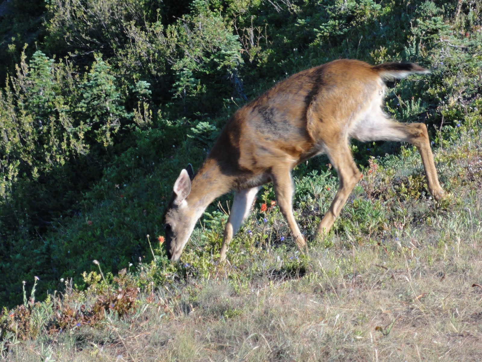
She completely ignored us. I probably could've stretched out a hand to touch her, but by the time I'd snapped off a picture, she'd crossed the ridge and disappeared into the cirque below. Those little buggers can hide themselves in very little cover, I'm here to tell you.
Both the moon and the sun beamed down on us the entire walk. Here's the moon peeking over the sandstone shoulders of the mountains:

How gorgeous is that, eh?
Up on Hurricane Hill, there's a lovely little tarn fed by late snowmelt, and a hillside of heather:

Okay, so that's not the best-framed shot in the universe, but I was standing in the middle of mosquito central just then, and I wasn't taking care to aim at anything but them.
After fleeing ye olde mosquitoes, we came to a calmer part of the trail, where we could appreciate the blush of the setting sun on snow-covered peaks with the glow of the moon above them:

And I could take a slightly-more relaxed photo of the tarn:

And here are the three M's of any highland hike: moon, mountains, meadow:

You can, y'know, kinda click on the picture so the moon's not a mere speck.
The sun slipped behind the mountains:

And so endeth day one. Much more to come, my darlings.


2 comments:
Nice pictures. I'm getting all nostaligic for hurricane rigde now. It's been about 15 years since I've been there. We got surrounded by deer too.
lovely and inspiring photos. wow.
Post a Comment