 |
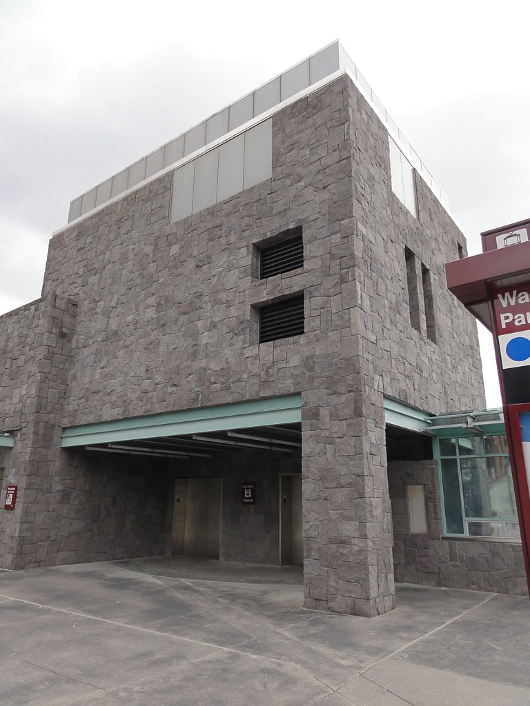
| MAX Light Rail Station |
 |
| Not the TARDIS, but it'll do as a time machine |
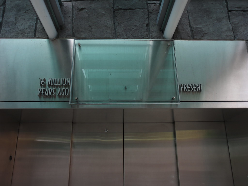
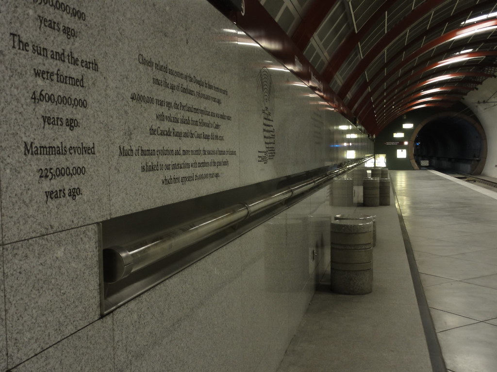
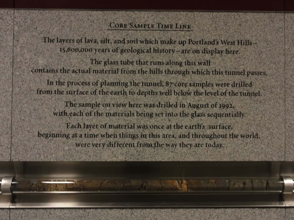
We don't often think about that, when we're going underground. But dig down below the soil, into the rock, and you're on your way to another age. Here, two hundred and seventy feet of vertical travel takes you sixteen million years into the past, back to the time when the Columbia River basalts were busy paving vast portions of Washington and Oregon. Its a world that bears little resemblance to our own. And it's all laid out for you to see.
All that history, mounted in tubes on the wall between platforms:
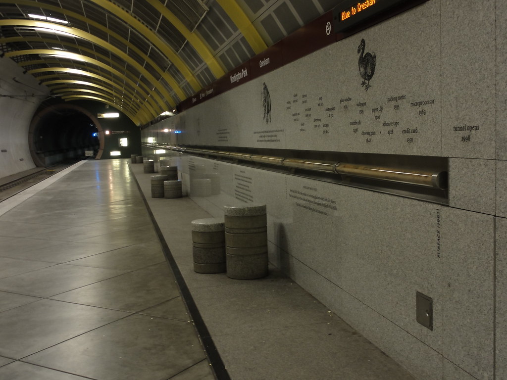 |
| Core East |
 |
| Core West |
 |
| Allow the Core Sample Timeline to introduce itself |
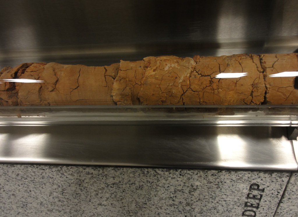
Let's begin at the beginning, nearly sixteen million years ago. As you begin walking the timeline (see slideshow below for the full experience), you're following the Winter Water Member of the Grande Ronde basalt formation. This is the oldest bit of the Grande Ronde on display, and it's thick - goes on along the wall for at least 15 feet. Something interesting about the Winter Water Member: it's one of the few you can recognize on sight. It, unlike other bits of the Columbia River Basalt Group, has plagioclase phenocrysts visible to the naked eye. I wish I'd known that when I was there, because then I might have found some in the core sample.
Following that, you'll come upon the contact between the Winter Water and Sentinel Bluffs Members of the Grande Ronde. Keep walking. You've got nearly thirty feet worth of basalt to go before anything else happens. And one thing that should be impressing itself upon you by now: that's a fuck of a lot of basalt. And it ain't even half over yet. Portland wouldn't have been the most comfortable city to live in for a while there.
But then, there was an interval. The Grande Ronde stopped flowing. All silent on the volcanic front.
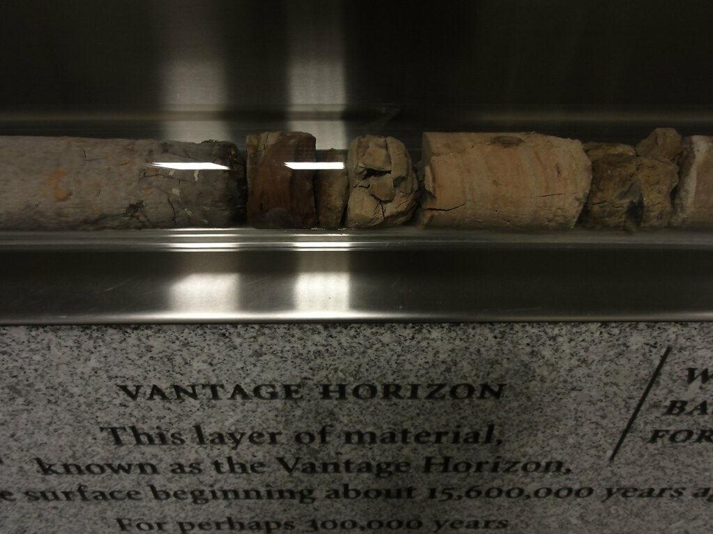 |
| Closeup of the Vantage Horizon |
Seeing those sudden paleosols after so much basalt is a shock and a delight. But don't get too used to it. Take a step, and bang! you're back in basalt. We're in the Wanapum Formation now. Wave goodbye to palesols and hello to nature's pavement. Flow after flow after flow of flood basalts spilled over this site. You are doomed to walk among it FOREVER! Okay, only for about forty feet or so, but still. That's a hell of a lot of basalt, and we're talking about almost a million years of molten rock. If your mind hasn't boggled, you've either spent too much time in deep time or you haven't got an imagination.
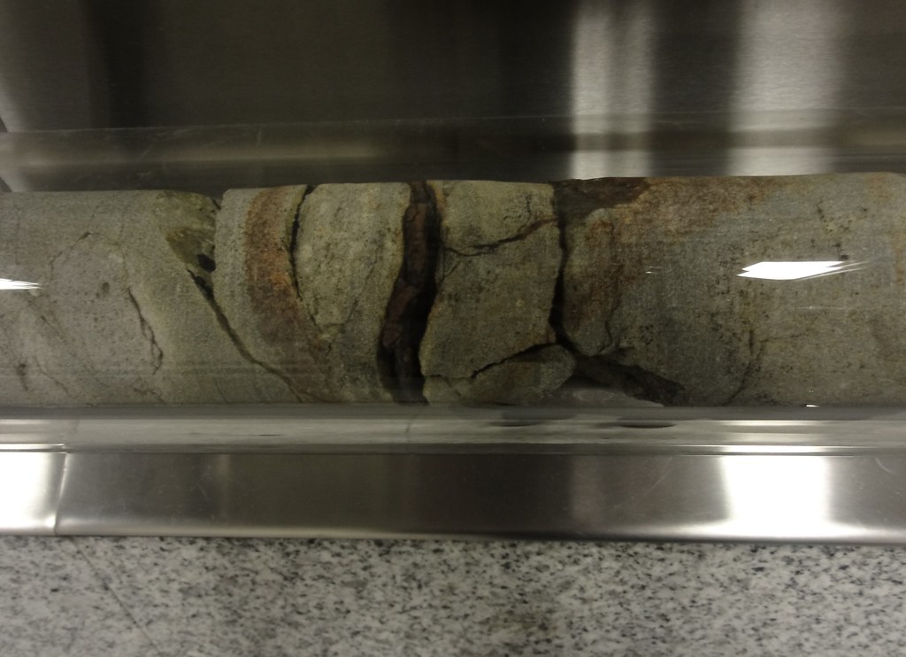 |
| Closeup of Wanapum Basalt |
 |
| Portland Hills Silt |
 |
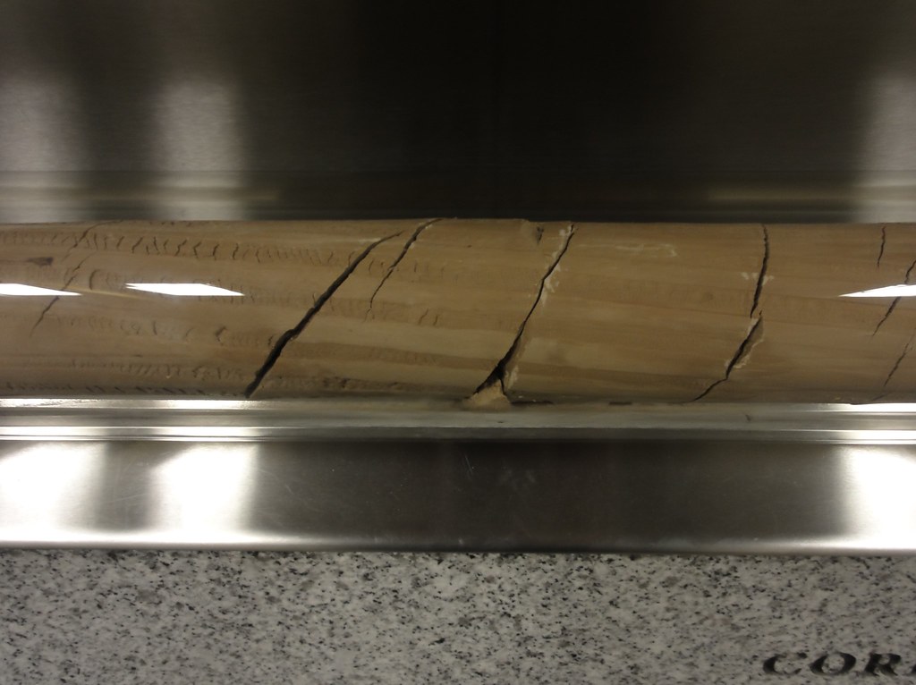
| More loess or loess is more? |
Lots and lots of loess. Lots. Apparently, there were glaciers, and winds sweeping over outwash plains, and the loess accumulated to enormous depths. You'll walk along about thirty feet of loess before anything else happens. Then you'll see that the place heats up a bit.
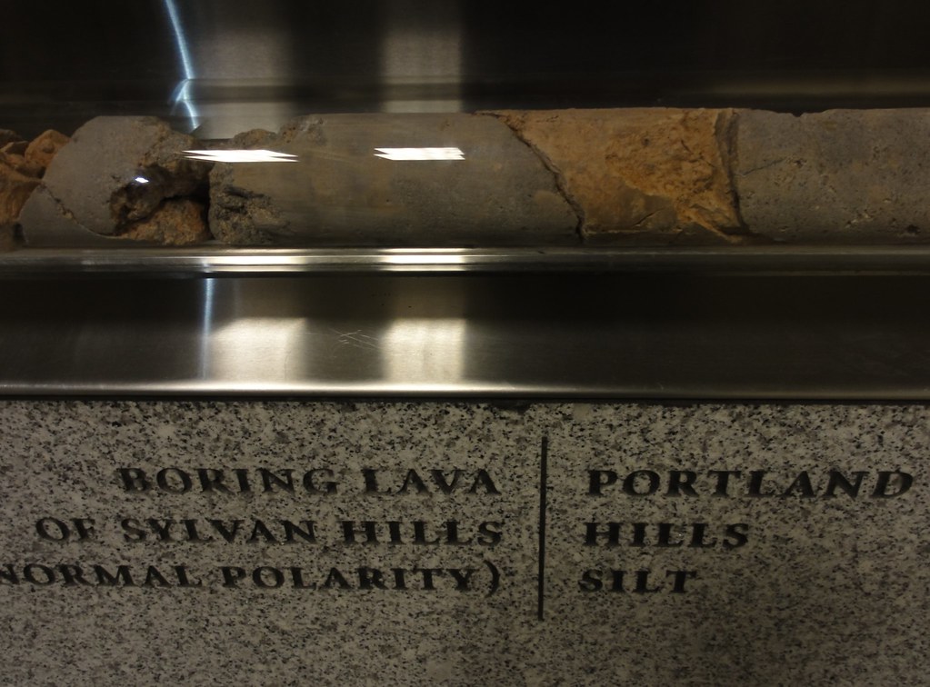 |
| Contact between Boring Lava and Portland Hills Silt |
The absolute neatest thing about it, though, is that reversals in the polarity of the earth's magnetic field are clearly marked on the core:
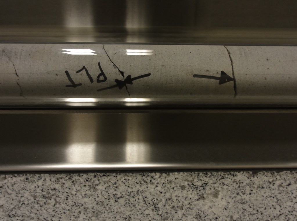 |
| Reverse the polarity! |
And you can see bits where the Portland Hills Silt and the Boring Volcanic Field battled it out for supremacy.
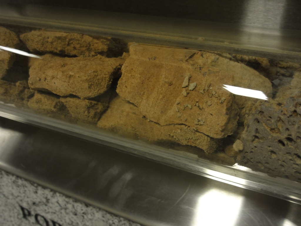 |
| Portland Hills Silt with a bit o' Boring Volcanic Field rock. Nice vesticles! |
And then, and then (and this is my favorite thing outside of the polarity reversals), the Floods came:
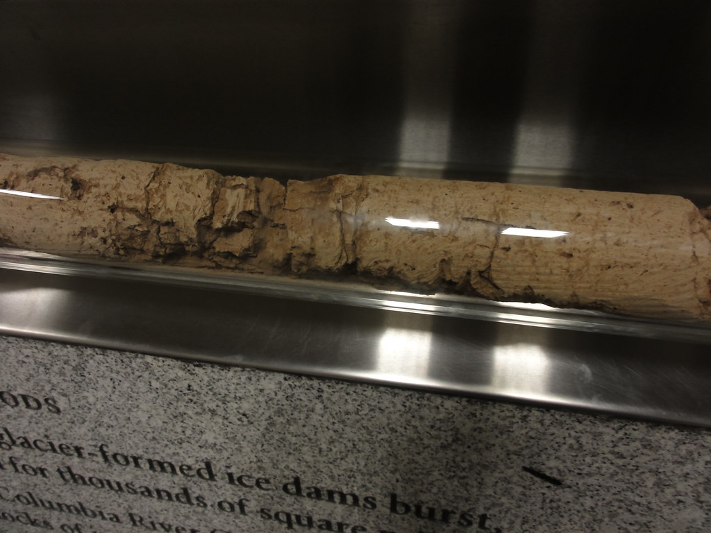 |
| Missoula Floods closeup |
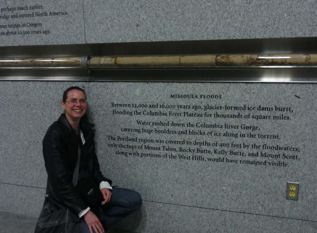 |
| Moi et Missoula |
It really is amazing to see so much geology in a tube like that, displayed with such loving artistry. If you get the chance, you should go see it for yourself. The scale of the thing can't be captured by a camera. But I've done my best, and here present you with a slide show of the whole thing, start to finish.
You've just walked nearly sixteen million years. How amazing is that?
Here endeth Oregon Geology Phase I. Never fear. Phase II cometh, after an interval in which we enjoy Mount Rainier, the Olympics, and quite possibly some Arizona geology. Believe me, I have no shortage of wonderful sights to show you. Stay tuned!
Some useful references:


5 comments:
how forking kewl dana! your post makes me wanna go down into that station and walk alongside that core
awesome!
(And a big thank you to Suzanne for introducing me to ETEV)
the core is incredible, kudos to whoever thought up the display and the wonderful walk of info.
As the late great folkie Utah Phillips said, the past didn't go anywhere, drop a rock on your foot, that rock's been here millions of years, and it's right here! the past didn't go anywhere ...
and thank you dana for helping me see the past that's all around us.
Oh, Dana, you've outdone yourself. How utterly cool to see cores that deep and continuous! (I'm a bit of a core junkie myself since the sand I'm working with came from drilling cores.) To see that someone(s) had the foresight to come up with a public display like the one you've shown is just wonderful.
That is SO cool. I am a huge fan of public displays of Science. Illinois has a "public art" law that requires public buildings to spend huge amounts of money on twisted abominations that do nothing to elevate or enlighten. This display does both.
Interesting, but where are the cyclist-chasing dinosaurs?
Post a Comment