We're at the end of our long journey, which began in
Astoria, continued through
Ecola State Park, Hug Point
north and
south, the
world's shortest river,
Cape Kiwanda,
Cape Meares, the
Columbia River Gorge, and some
truly tremendous waterfalls.
Now here we are at Crown Point, where the Vista House gleams like a jewel in the crown:
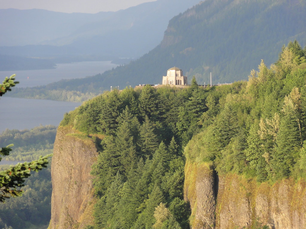 |
| View of Crown Point from Chanticleer |
And I could do a proper write-up, but I'd mostly just be repeating myself. We'll have more images than words this time round, I should think.
 |
| Floating in the Void |
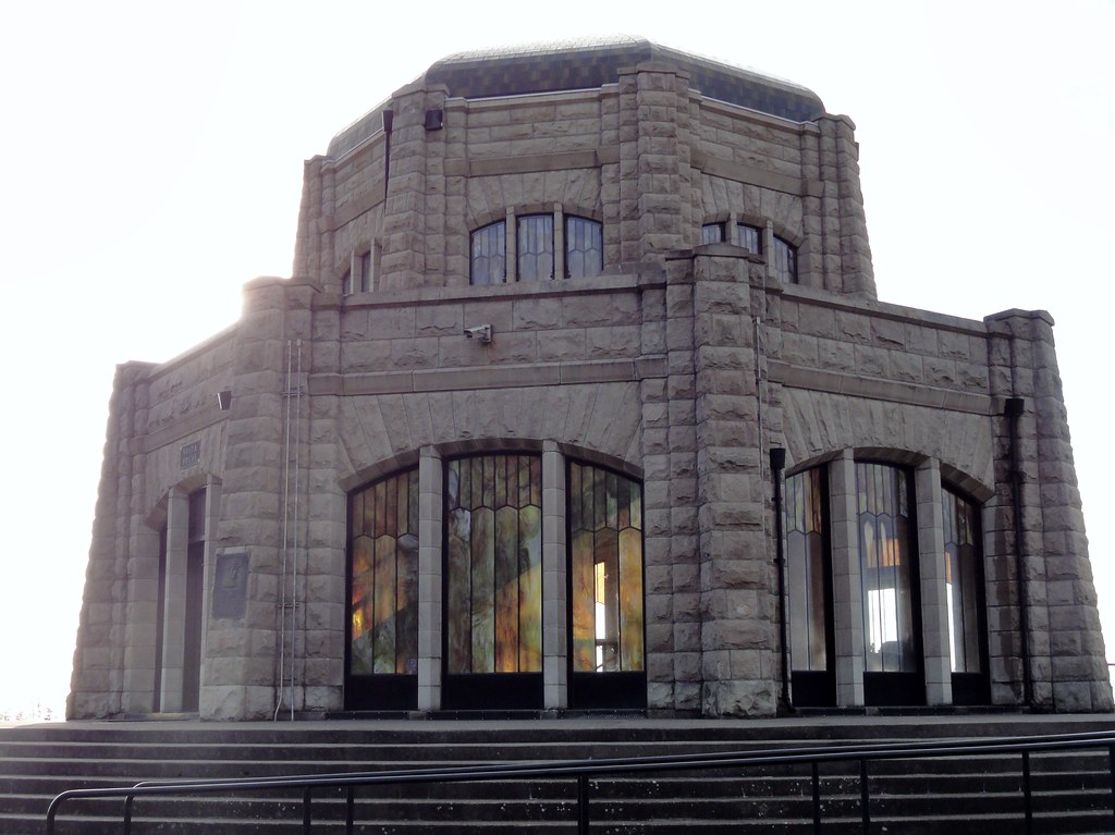
Now, it may look like I retouched the above photo, but I didn't. All natural. That's the
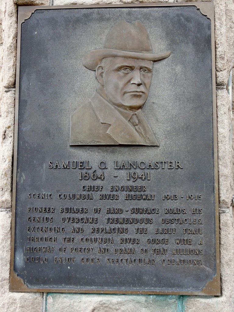
Vista House against a cloudy sky. It's a gorgeous building, conceived by Samuel Lancaster as a place where travelers on his wonderful highway could contemplate the Gorge. He also mentioned "silent communion with the infinite," which any Terry Pratchett fan will love.
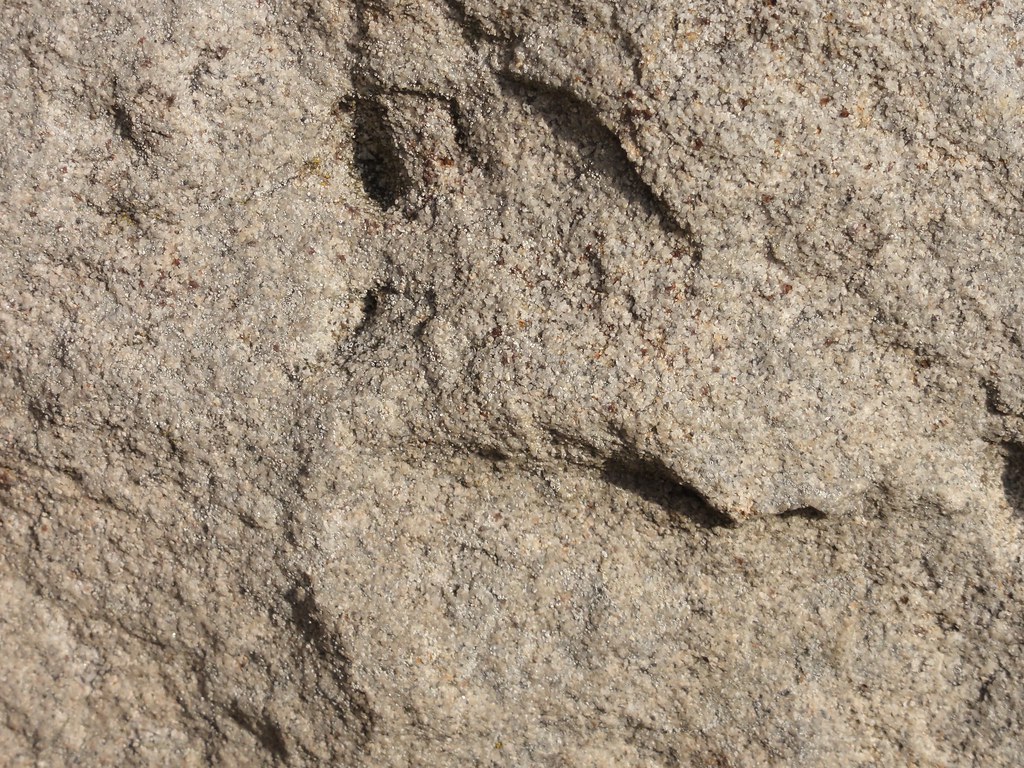 |
| Sandstone Closeup |
It's built of sandstone blocks that glow golden in the sun. One can get very friendly with that building. It's some pretty wonderful architecture, possibly the only thing that can draw one's attention away from the jaw-dropping geology of the gorge. Those rough-hewn blocks are delightful.
And here it is, with the Gorge as its backdrop:
 |
| Vista House |
Here's the man to thank for all this beauty:
Now, walk down the road a bit toward a curlicue of concrete and a lamppost:
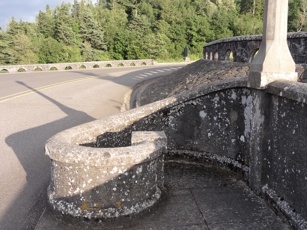 |
| Ooo, Interesting |
Here you'll find a treasure sure to delight any geology geek:
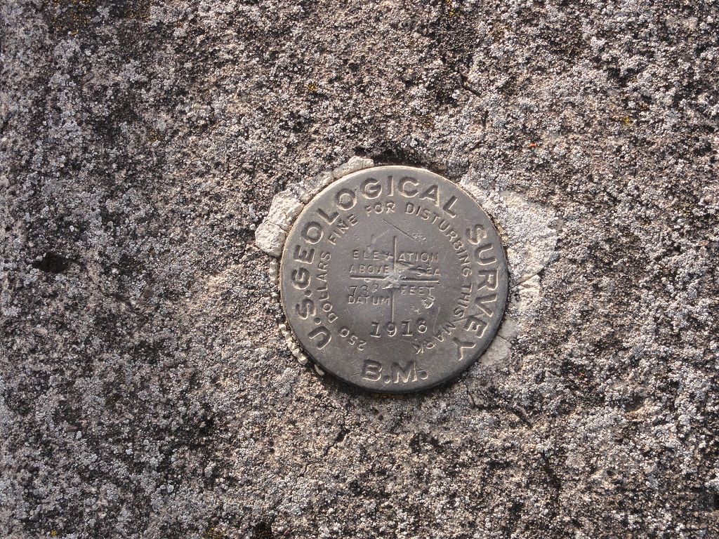 |
| USGS Benchmark |
Now, if someone could be so kind as to explain exactly what these benchmarks are in the comments, I'd be eternally grateful. My Google-fu has failed me.
And with that, we've left the Gorge. Stop for just one last, lingering look from Chanticleer Point:
 |
| Gorge and Vista House |
It's amazing what geological processes and human beings can create when they collaborate.


8 comments:
The benchmarks should be known elevation marks, used for topography.
http://www.geocaching.com/mark/
Also, FYI the basalt flow Vista House sits on is actually a filled river canyon. It's an ancestral Columbia River route that was filled in by the CRBs.
http://vulcan.wr.usgs.gov/LivingWith/Historical/LewisClark/volcanoes_lewis_clark_april_06_1806.html
A benchmark represents a spot with a known location and elevation that has been surveyed. It is used for example as a starting point for more detailed surveys. Since surveying requires line of sight, Crown Point is an ideal location for one. The disk is put there so that if you need to re-do the survey you can set the instrument up in the same place and replicate the survey. This benchmark also tells you that it was done by the USGS. If you could look along the railroad in the gorge you would find primary benchmarks (which this one is not) as levels in western surveys were taken from the railroad and run from there, since elevation is of importance to building a railroad if you get to steep the locomotive can't get up the hill.
Love the Vista House photo with the light coming through the windows! I saw Vista House on a sunny day, midday (many years ago now, sigh) and it was really too bright to get good window photos.
I love the wonderful variety of Northwest geology, but for sheer jaw-dropping wonder it's hard to beat the Gorge.
I'm so glad you fond the historic highway. It's THE way to see the gorge; so many zoom through on I-5 and miss most of it. The view from Chanticleer is, for me, the iconic view of the gorge, and not many people even know where it is. Gorgeous photos!
Super photo of Vista House.
Ok. Every time you do a Oregon trip post I want to hop in the car and just go. Go somewhere - Oregon. Are you a secret Oregon promoter?
Here's a handy link about Survey Benchmark Monuments. One of the first hits I get searching for 'Benchmark Monuments' is for the city of Woodburn, OR; maybe they were extra common out here?
This 1984 issue of the Ore Bin / Oregon Geology magazine has a nice piece on the Neogene Gorge, including Crown Point, as part of a field trip.
Dana, this series is amazing. Have I said that before? If not, I should have, so here it is again; this series is amazing.
Post a Comment